

With the rapid development of technology, underwater drones are being increasingly widely used in fields such as marine exploration, environmental monitoring, and search-and-rescue operations. However, achieving precise positioning and navigation in complex and ever-changing underwater environments remains a significant challenge. The Ultra Short Baseline (USBL) positioning system, as a high-precision underwater positioning technology, can provide accurate position data for underwater drones, enabling efficient underwater operations.
An Overview of Underwater Drones
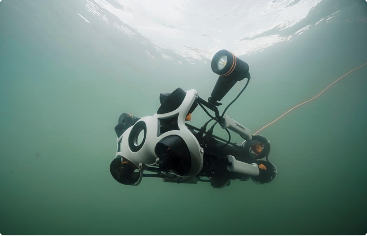
An underwater drone is a robotic device that can operate autonomously or remotely underwater, typically equipped with cameras, auxiliary lights, sensors, and other equipment. They are widely used in the following areas:
- Marine Exploration and Research: Collect marine data and samples, and study marine organisms and geological structures.
- Environmental Monitoring: Monitor water quality, detect pollution sources, and protect the aquatic ecological environment.
- Search-and-Rescue Operations: Conduct search-and-rescue tasks in incidents such as shipwrecks and plane crashes.
- Underwater Engineering: Perform underwater inspection, maintenance, and repair work, such as the inspection of oil and gas pipelines and cables.
An Overview of the USBL Positioning System
The USBL (Ultra Short Baseline) positioning system is a type of underwater positioning system that utilizes ultra-short baseline technology. Its working principle is as follows: an ultra-short baseline transmission and reception array installed on a ship sends acoustic signals to the underwater drone; a transponder on the underwater drone receives these signals and transmits them back. Based on the time difference and phase difference of the returned signals, the system can calculate the three-dimensional position of the underwater drone.
The USBL system has the following characteristics:
- High Precision: It can provide centimeter-level positioning accuracy in complex underwater environments.
- Real-Time Positioning: It can track the position of the underwater drone in real time, improving operational efficiency.
- Easy Installation and Use: Compared with other positioning systems, the USBL system is simpler to install and more convenient to use.
The Integration of Underwater Drones and USBL
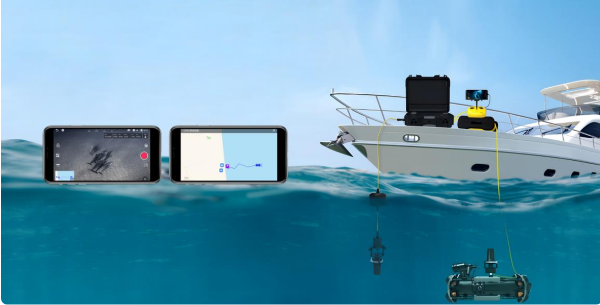
Integrating underwater drones with the USBL positioning system allows the full advantages of both to be leveraged. Users can view the real-time position information and trajectory of the ROV (Remotely Operated Vehicle) on a map, significantly enhancing the efficiency and precision of underwater operations. This integration not only ensures accurate navigation and positioning but also provides a clear visual interface, facilitating real-time monitoring and command.
Key Benefits of the Integration
- Precise Positioning and Navigation: The USBL system can provide high-precision, real-time position data for underwater drones, enabling them to navigate accurately in complex underwater environments.
- Improved Data Collection Efficiency: In marine exploration and environmental monitoring, underwater drones are required to collect precise data or water samples in specific areas. The high-precision positioning capability of the USBL system helps drones quickly reach target areas, improving the efficiency and accuracy of data collection.
- Enhanced Search-and-Rescue Capabilities: In search-and-rescue operations, underwater drones need to search for targets over a large area. The real-time positioning function of the USBL system allows rescuers to accurately track the drone’s position, quickly locate wreckage or targets, and increase the success rate of search-and-rescue missions.
- Optimized Underwater Engineering Operations: During underwater engineering inspection and maintenance, the USBL system can help underwater drones precisely locate targets such as pipelines and cables, ensuring comprehensive inspection and accurate maintenance while reducing the risk of missed or false detections.
The integration of professional underwater drones with the USBL positioning system has brought about a revolutionary change in underwater operations. The high-precision positioning and navigation capabilities enable underwater drones to perform various tasks efficiently and accurately in complex underwater environments. Real-time map display of the ROV’s position information and trajectory further enhances the visualization and monitoring capabilities of underwater operations, bringing more innovations and breakthroughs to fields such as marine exploration, environmental protection, search-and-rescue operations, and underwater engineering.
In the future, with the continuous advancement of technology and the deepening of applications, the integration of underwater drones and USBL systems will undoubtedly open up new horizons for humanity’s understanding and utilization of marine resources.
